Friday, May 31, 2013

Sumpter, OR

Day 13: Friday, May 31, 2013
Prairie City to Sumpter: 46 miles


Today was the day of the three passes. They weren't high: 1500', 1000', 800'; but they came bang! bang! bang! one right after another. Yeah, there were downhills in between, and for that I'm thankful. But by the time it came to turn to Sumpter (3 miles) or Baker (27 miles), it was an easy decision. I didn't want to do a 70-mile day with three passes.

Besides: I have always regretted not going to Sumpter 32 years ago. We made the push to Baker, because Sumpter was off the route, and we had no idea what was there. This time I did, and I didn't want to miss it. So I headed for Sumpter. That would give me time to see what I wanted to see and have a lazy ride to Baker the next day.

Despite (or maybe because of) the three passes, the scenery was superb. Lush green valleys, snow-capped mountains, stands of Ponderosa pine.

mountain range south of Prairie City
Snow- and cloud-capped mountain range
south of Prairie City


The Sumpter Valley Railroad was started in 1890 for the purpose of delivering machinery to logging camps and the gold fields in the Sumpter Valley and beyond, and to carry logs out of the woods. By 1910, the railroad reached Prairie City via a circuitous route to navigate those three passes. But, like so many other small railroads, it had a short life. Exhaustion of timber, the decline of gold mining, and improvements to roads severely cut its freight and passenger revenue. The railroad pulled out of Prairie City in 1937, and went belly-up in 1947.

Much of the railroad's right of way has been reclaimed by the forests or covered by new roads. Working my way up one of the passes, I stopped to walk a bit of the old right of way. A short section had been cleared, and rails laid, as a kind of memorial to what used to be.

SVRR memorial track section
An SVRR memorial track section
in a clearing in the forest


old SVRR roadbed
Can you see where the track used to run?


The town of Sumpter was one of numerous gold-mining centers that dotted the valley and the surrounding hills. Today, it's a sleepy shadow of its former self. I spent the night at the Sumpter Stockade, a motel/camping spot made to look like something out of the old west. It was quite comfy - the shower felt good! I copped out on cooking again, and had a chef's salad at a rustic restaurant down the street.

the Sumpter Stockade
The Sumpter Stockade:
motel, camping, event center


Sumpter Stockade gazebo
The gazebo was intended
to host weddings and other events

Thursday, May 30, 2013

Prairie City, OR

Day 12: Thursday, May 30, 2013
Dayville to Prairie City: 47 miles


It was a short day today. But it felt longer than yesterday. Yesterday was fun, both because of the downhills and because of the scenic wonders. Today's journey led us (the British cyclists and me) up the John Day River valley, on rolling uphills over a nicely paved highway with generally wide shoulders. It should have been a piece of cake.

But I stayed up until 2:30 last night, trying to catch up on my blogging, and 7:00 am came awfully early. After doing my laundry and some more blogging, and tidying up the hostel, it was after noon.

Big Al in Powell Butte might say he serves the best burgers in Central Oregon; but, for the money, I'll take those served at the Dayville Cafe. The buns were soft and tasty, and the fixin's were just right. After finishing a burger and salad and a bottomless Pepsi, I was stuffed. Maybe that's why I didn't feel much like riding.

Dayville Cafe
Stop here. Eat. Burgers good.


The first 30 miles were fine. Compared to yesterday, the scenery was kinda monotonous - more of the same, but lower hills with not so many rock outcroppings, and cows and forage crops. The sparse traffic we'd had since Prineville became denser - maybe a car every couple of minutes now - and it wasn't as easy to ride along without worrying about traffic.

forlorn
Forlorn


As I was passing through John Day, a biker flagged me down. I think she had me confused with someone else. Or maybe she was just offering her services. She lived there, and was a warmshowers person, and ran an inn for cyclists, so maybe she was just trying to drum up business. A group of cyclists had gathered, in preparation for a pleasure ride; and a loaded cyclist from Missoula, headed for points west, was also there. We chatted for a while, then one of the cyclists headed home to Prairie City. Apparently he commutes the 26-mile round trip between Prairie City and John Day on a daily basis. I couldn't keep pace with him - all the usual excuses apply. Besides, I was really dragging after 30 miles of even a gentle uphill.

name these flowers
Name these flowers


The Brits and I are camped at the Sumpter Valley Railroad depot - the same spot Jack and I camped at back in 1981. The last train out of Prairie City ran in 1937, so I don't think I'll be able to get a ticket to Baker City. I should have roughed it and cooked an evening meal over the campstove, but I wimped out. We all went downtown to a bar that served good food. I had rosemary garlic shrimp with fettucini, and it looks like I'll also have that for breakfast.

Prairie City depot
The Prairie City depot


three tents
Three tents

Wednesday, May 29, 2013

Dayville, OR

Day 11: Wednesday, May 29, 2013
Ochoco Lake to Dayville: 80 miles


breakfast at Ochoco Lake
Breakfast at Ochoco Lake


Today was fantastic!

Let's get the stats out of the way first: 24 miles up, 17 miles steep down, 7 miles up, 25 miles down, 7 rolling miles along a river. Total: 80 miles, the longest day so far - and it was great!

Those downhills - especially the 25-miler - have restored my faith in the value of uphills. Of course, the uphills had worth in and of themselves: they gave me time to observe the red-wing blackbirds flitting from fencepost to tree, calling to each other with their soft tink! tink! and then fleeing with a warning chirrup! chirrup! when they realized I was near; the three hawks soaring in a thermal only fifty feet over my head. But the downhills were a blast! Especially that 25-miler. On one grade, I surprised a group of mule deer, grazing in a farmer's field, and they bounded away with their characteristic springy gait. And on the other side of the road, a small herd of cows took fright and headed down-path, and I felt for all the world like a cowboy. Don't ever think you can outrun (or out-bike) a cow! (At least with fully loaded panniers.)

Mitchell is at the bottom of the first of those downhills. The entire town could fit into a Costco parking lot. I stopped to visit and to have a bowl of taco soup at the Little Pine Cafe. Yum! Excellent! It gave me the energy I needed to climb to the top of pass #2.

Mitchell
The entire town of Mitchell (almost)


Prineville seems to be the dividing line, traffic-wise, between the more heavily populated western Oregon and the open spaces of central and eastern Oregon. There were times today when five minutes went by before a car came along. The constant whiz-whiz of cars and trucks can really detract from the pleasure of cycling, and today's lack of vehicle noise let the sounds of nature through and made the day much more enjoyable.

I haven't mentioned the scenery yet. Wow! Every bend in the road opened one panoramic vista after another. My photographs can't do them justice. Blue skies and 5-20 mph tailwinds eased my way through the day. The terrain, of course, is mountainous, with Ponderosa and lodgepole pine, and the valleys are heavily irrigated, primarily to produce forage crops for cattle, it appears, which typically graze on the scrub-filled hills. This area is home to the John Day Fossil Beds and Painted Hills. I wish I'd had time to make a side excursion to see them, but I had to make Dayville by dark, and it was a long day.

fantastic views
One fantastic view after another


another
Another...


triceratops mountain
Triceratops Mountain


...and another...
...and another...


...and another
...and another


Today was the first day I met any TransAmerica cyclists. A pair of cyclists from Dorset, in the south of England, overtook me on the first hill. We chatted a while, comparing experiences so far. They were traveling light, compared to me. Not long after they left, they were out of sight. On the second hill, I met a cyclist who was doing the trail backwards - east to west. That's generally considered harder, because it's against the prevailing winds. Besides, I wouldn't have wanted to do today's ride backwards. The grades that direction would have been a lot less rewarding.

In 1981, due to flat tires, Jack and I made it only as far as an island in Rock Creek, where we spent a pleasant night. Now, Rock Creek is behind a fence, with big "No Trespassing: You Will Be Persecuted" signs. So I cycled on in to Dayville. The Presbyterian Church there runs a hostel for cyclists: we can stay inside, in the social room (and even sleep in the sanctuary!), and they have a shower with towels, and a laundry room, and a kitchen, and even some food! Not to mention wi-fi. It is a really cool place! They've been doing this since 1975.

Dayville church
The Presbyterian church in Dayville
runs a hostel for bikers.


church social room
The British cyclists in the social room


The British cyclists had stopped here for the night as well, and we chatted some more before hitting the hay.

Tuesday, May 28, 2013

Ochoco Lake, OR

Day 10: Tuesday, May 28, 2013
Redmond to Ochoco Lake: 31 miles


Once you cross the Cascade Range, the climate and terrain change appreciably. Gone are the wet rain forests and towering firs, replaced by Ponderosa and lodgepole pine, desert, and sagebrush. Also see the 1981 post for some cool pictures.

The striking dichotomy that I observed - which exists all across the west - is the stark contrast between the native vegetation and the heavily irrigated fields. Much of the water that descends from the mountains in the spring is rationed out to farmers, who in central and eastern Oregon use it mainly to water crops that are intended as forage for cattle and horses. Canals lace the landscape to deliver that water where it is needed.

irrigation and sagebrush
Irrigation and sagebrush


At Powell Butte, shortly after Redmond, there was a burger stand by the side of the road. It was done up in a fireman theme (the owner was a retired firefighter), and featured what some publication had declared the best burgers in central Oregon. Of course, I had to stop. That burger made for a good breakfast!

Big Al's
Big Al's burger stand


Big Al's Barn Burner


The descent into Prineville was both exhilarating and picture-worthy. I doubt if this photo will do it justice. The road wraps around three hills on the way down, with Prineville in the valley below.

Prineville descent
The descent into Prineville


When Jack and I did McKenzie Pass, we went all the way from Frog Campground to Ochoco Lake. But that was with good weather. Since I had stopped in Redmond, I thought I could make it all the way to Ochoco Pass today. But the temptation to stop at Ochoco Lake was too strong. And it turned out to be a fun experience. And a free meal.

First, let me say that I've been pronouncing it incorrectly all these years: o-CHO-co. Nope. It's OACH-a-co.

It was at Ochoco Lake State Park that Jack and I met Guy and Rick, two fellow bikers who had also stopped to camp there. The park was now a county park, and it was excellently maintained. And the host, a spry man of 81, offered me a can of pop. "I do that for all cyclists," he said. So I decided to spend the night.

In 1981, there had been a restaurant across the highway from the park. That was where we met Hermon Hoffer, our 74-year-old friend from Michigan who was also doing the TransAmerica Trail. See a shot of him outside the restaurant here. Now, the restaurant is closed.

closed restaurant
Hermon Hoffer isn't here.


A couple from back east, who were touring part of the west in their camper-van, invited me over for dinner, and we stuffed ourselves on pork chops and corn on the cob, followed by moose tracks ice cream and an evening of pleasant conversation. The wife was into genealogy, and they had some amazing stories to tell about their adventures both here in the US and in Croatia, which they visited not long after the Serbian-Croatian conflict.

dining al fresco
Dining al fresco

Monday, May 27, 2013

Redmond, OR

Day 9: Monday, May 27, 2013
Alder Springs Campground to Redmond: 55 miles


Of course, it rained all night. But ya gotta do what ya gotta do.

Compare the following photo with the one of Jack from 1981, same location.

wet 4000 feet
4000 feet and wet!


steep but beautiful
Steep but beautiful


More rain, all the remaining 11 miles (and 3 hours) to the summit, and more and more wind, as I went up.

snow at the top
Not quite ready for cars


At the top, it must have been doing 30 mph, with rain! Believe it or not, I met about a dozen bicyclists who were just climbing the mountain as a day trip. And I couldn't believe how much skin was showing on some of them! Here I was, in my rain jacket and hood and rain pants and booties and suffering, and they had bare legs!

bare skin
Lookit all that bare skin!


at the top
At the top, all bundled up


The top of McKenzie Pass features at least a trio of long-dormant volcanoes, and their broken-up lava flows dominate the landscape over an area of 50 square miles. Only the occasional tree manages to garner a toehold among the lava rocks.

I rode down the other side with three of the scantily-clad cyclists - only 20 minutes to the snow gate - and, its being the east side of the mountain and the clouds having dumped most of their moisture on the way up, the rain eased. With the help of a tailwind and a gentle downhill, the 15-mile ride into Sisters took under an hour.

at the bottom
Sun at the snow gate!


I remember Sisters as a sleepy little town. Now it's a tourist trap. The cars were bumper-to-bumper down the main street - tourists returning home after the Memorial Day weekend. I stopped at a bakery, then made my way out of town.

But not very fast. My tire pump, which had gotten its first use on the way up the mountain (I had stopped to help some bikers in distress), got its second use a few miles past Sisters. A 3/4" screw went straight into the rear tire. It plugged the leak fairly well, but the tire would have gone flat eventually. And, of course, when I unscrewed the screw, the tire went flat immediately. And, in the process of pushing the bike a short distance to a safe worksite, the tube rotated in the tire and sheared the valve stem off.

screwed
I've been screwed!


Not to worry. I carry extra tubes. And a tire. Since the tire wasn't long for this world, I changed it, too. The rest of the ride to Redmond was uneventful. I stopped at Hutch's, a bike shop, to pick up some chamois butter, and met another cyclist who was traveling with panniers, a trailer full of stuff, and a dog on top of it all. He said he'd been traveling since he was 15 and hadn't stopped, and he could give me travel advice on just about anywhere between here and Rio! And he gave me a can of ScotchGuard to treat my panniers.

After doing McKenzie Pass, I wasn't much interested in setting up a soggy tent and dealing with soggy clothes. So it was off to another Motel 6. I strung a clothesline and hung everything to dry, and the bed felt quite good.

motel clothesline
Tonight's drying room

Sunday, May 26, 2013

Alder Springs Campground, McKenzie Pass, OR

Day 8: Sunday, May 26, 2013
Vida or thereabouts to Alder Springs Campground: 34 miles


(Note that the link above shows the route all the way up to the pass. Google maps is funky on a tablet.)

Yes, it was a short day today. But sometimes you just have to make your decisions based on the available facilities.

drippy morning
It was a drippy drippy morning


It was raining when I awoke. The forecast called for a nasty day up on McKenzie pass. I debated whether to go back to Eugene and become a hippie. A forty-minute therapy session over the phone with De helped motivate me. Plus, the sun was coming out.

So, onward. The west wind pushed cloud system after cloud system up the McKenzie River valley, producing alternating periods of sun and discouragingly heavy rain. I stopped for lunch at a diner to avoid one of those cloudbursts; of course, it was sunny the whole time I was inside.

At the restaurant, a fellow diner came up to me and asked about my journey. He mentioned his neighbor, Joe Kurmaskie, and wondered if I'd heard of him. Well, duh! Who hasn't heard of Joe Kurmaskie? Chris and I have even been to his house. But I bet he wouldn't know me from Adam.

The diner's wife happened to be a seamstress for the television show Grimm. Interesting.

Past McKenzie Bridge, cyclists have the option of staying on Route 126 and going the long way around, over Santiam Pass. It's longer, the grade up to Santiam Pass isn't bad, and there are good paved shoulders, but there's a lot more traffic. Or they can turn off onto the old McKenzie highway, which is a very scenic, narrow, winding road with absolutely no shoulders, and a steeper, longer climb to McKenzie Pass, which is higher than Santiam. I took door #2.

narrow road
Narrow road, tall trees, sun!


scenic bikeway sign
Scenic even in the rain


There was good reason for that. McKenzie Pass was still closed to cars, but was accessible to cyclists and hikers. Snow gates approximately halfway up meant no traffic beyond that point, and only hiker/biker cars below. And there was a campground at the snow gate. Which was a good thing, because I wouldn't have made it over the pass before dark. And it wouldn't have been easy to find a level camping spot higher up.

little bitofrain
A little bit of rain didn't hurt.


at the snow gate
At the snow gate


So I set up my tent, and after a meal of tomato soup fortified with a couple of packets of instant oatmeal, I bundled up and crawled into the sleeping bag. I think this is the first time I've ever camped alone in the middle of the mountains.

I wish I'd bought a Surface Pro


I wish I'd bought a Surface Pro.  Or a Windows notebook.

I started out with an Apple. An Apple ][. When it became obvious that the business world was going with the IBM PC and its clones, I shifted over to MS-DOS, and never looked back. When Windows started to make inroads into the business arena, I thought that it was a bunch of glitz and totally non-productive for programmer types. But I've gotten used to it.

Collin is a Linux fan. He's anti-Apple on principle, and grudgingly uses Windows machines. His feelings have helped to influence some of our purchasing decisions. Including the ones I made when choosing equipment for this trip. Of course, another factor was cost.

I bought a Samsung Galaxy Tab 2 10.1 for $279 at Costco, and found a Logitech K810 bluetooth keyboard for $60 at Best Buy. The keyboard is really cool. One charge of its batteries will power it for about 700 hours. But if you turn on the backlights, like I'm doing now (it's dark here in the tent!), it will run for about 20 hours. Still not too bad.

So what's not to like? Android. The Android software market is really fragmented. Everyone and his brother is writing apps for Android. A lot of them are free. Which means, a lot of the time, that ads appear at the bottom of the screen while you're using the app. I find that really annoying. It also means that there are a lot of stupid apps out there, and useful ones that are not well thought out, and a lot of apps with non-standard interfaces. And even the apps that are written by the big companies (e.g., Google, with its Blogger app) bear only a passing resemblance to their full-featured implementations on Windows and the Mac.

Part of this is due to the really dumb way that Android has implemented text-marking. The primary - no, only - reason to mark text, the Android gods feel, is to delete, cut, or copy it. You can mark it with your fingers, which is really clumsy and doesn't work well 75% of the time; or you can use keyboard shortcut keys. But not all Android apps recognize the standard Windows shortcut keys (Shift-Ctrl-Arrow, etc.) as text-marking keys. And if you are working with an application that allows you to highlight text and then make it bold, or italic, or a link to a webpage, the text-marking turns off when you press the Bold or Italic or Link button, witlh the result (at least in Blogger) that the bold/italic/link html is placed at the end of the file, and not on the text you selected (which isn't selected any more).

Let's continue this rant. Tablets and smartphones are designed so that a physical keyboard is not required: a virtual keyboard pops up onscreen when you need to enter some text. Touch typists find these virtual keyboards well nigh impossible to use productively. So they hook up a bluetooth keyboard and type with that.

But the problem with that is that, any time you use your finger to point to a text field on the screen, the virtual keyboard pops up, and you have to press the Esc key or an on-screen button to get rid of it. There must be a way to disable the on-screen keyboard when a physical keyboard is hooked up, but I don't know it. (If you do, let me know!) This is just a nuisance, but one I could do without.

So what's the alternative? The Microsoft Surface Pro. It can run a full version of Windows, and it can run any Windows application. It's the next thing to being at your desktop. I think I'd love it. The drawback? It's $1000 with additional memory, and the touch keyboard is another $120, if memory serves me. That comes to over three times as much as I paid for the Android tablet and keyboard!  Or I could get a nice Windows notebook from Lenovo that costs about what I paid for the tablet and keyboard.  I shudda done that.

Of course, one advantage of the Android environment is the wide choice of free or inexpensive software that's available for it. But I sure think I'd be a lot happier, and more productive, running all my old familiar applications in the Windows environment.

Quick Update

Rain. Wet. Bike repair. Rain. Wet. Rain. Did I mention wind? Dallas to Corvallis with 15-20 mph headwinds and rain. Sat out predicted bad weather in Corvallis. Bad weather wasn't that bad. Corvallis to Eugene - wind, but not bad. Replaced bottom bracket in Eugene. Eugene to Vida - nice day. Start pouring just as I got the tent set up. Rained all night. Headed for McKenzie Pass but forecast doesn't look good. Yuck. I hate Android tablets. Rant will be subject of next post.

Saturday, May 25, 2013

Vida, OR

Day 7: Saturday, May 25, 2013
Eugene to a little past Vida: 54 miles


Well, the automatic sprinklers proved that the tent was pretty waterproof - except for the floor, which is rapidly losing its waterproof coating. I was up shortly after the sprinklers shut off, and packed up and headed for a bike shop - my bottom bracket was acting squirrely and making clicking noises.

Eugene is a funky town. It's like the '60s and '70s never ended. I saw a lot of hippies, a lot of tie-dye, and some honest-to-gosh weirdos. One guy was dressed in a thong bikini (both top and bottom!) and was biking along, yelling at people. Eugene is a very bike-friendly town. It has a good network of bicycle paths, and many of the downtown streets have bike lanes.

Eugene bike bridge
A bike/ped bridge in Eugene

Eugene has a number of good bike shops. I stopped at Paul's Bicycle Way of Life, on the east-west bike path, and they referred me to their downtown store. There, the mechanic told me he was booked solid for a couple of days. But Michael Martin, the store manager, overheard me discussing my situation with a customer who was interested in my journey, and got my bike into the back room immediately. An hour later, I was outfitted with a new bottom bracket and several new cables. Talk about service.

The customer I had talked with was a member of warmshowers.org. Members provide showers (and, optionally, other services) for fellow cycling travelers, and in turn can find fellow members as they travel across the country. It's a cool setup. I had meant to sign up before leaving on the trip, but didn't get around to it. One of these evenings...

By the time the bike was ready to roll and I found a bit of lunch, it was 3:30 pm. Well, I wasn't going to make it to the campground at McKenzie Pass today. At least the weather turned out to be very nice. I took the long way out of town, retracing my route back to Coburg and following McKenzie View Drive along the McKenzie River. It was rolling and scenic, nothing like the major eastbound highway Jack and I took out of town back in 1981. But I eventually had to join that route, which becomes the McKenzie highway and follows the McKenzie River.

McKenzie River homestead
Homestead along the McKenzie River


coach sculpture
...but what's its mileage?

covered bridge
Covered bridge over the McKenzie River

Somewhere around Vida, it started to get dark. There weren't that many places to stay. The clerk at a general store had a list of local B&Bs, and one of them accepted campers. It turned out to be quaint and rustic, and the hostess was a sweet old lady, but it was overpriced for campers at $25. That's life. The rain had held off all day. But it made up for it that night.

Friday, May 24, 2013

Eugene, OR

Day 6: Friday, May 24, 2013
Corvallis to Eugene: 58 miles


One nice thing about traveling alone is the freedom to set your own schedule. I went to bed at 9:00 pm, got up at 2:30 to do more blogging, then fell asleep again at 6:00 am. Then I overslept and didn't waken until 8:30. What decadence!

Enough of this lazing about in the luxury of a heated motel room. It's time to hit the road.

Well, it was dry today. But the wind, which had been so kind the first couple of days, had shifted around to the south as the front came through. And it was still blowing. Not until mid-afternoon did it shift to the west and ease up. But that, and a lifting of the overcast, did wonders to improve my pace. Still, the 40 miles to Eugene would have to suffice for the day.

As in 1981, the valley is filled with a wide variety of crops, many planted for research and to breed seeds that are better suited to the Willamette Valley climate. This research is carried out both by the state and by the state universities. I saw acres and acres of tall fescue and other grass crops that were grown both for forage and for seed for farmers and for homeowners. White clover was in abundance. There were seas of white - the flowers of a plant whose leaves resembled radish, but much larger in size. I stopped to talk with a scientist at a grass testing station. He explained that all the cross-breeding that is done is entirely Mendelian genetics - none of this gene-splicing to introduce traits such as herbicide resistance that has raised such a storm world-wide. He said that there are really very few institutions that are still sticking with the old-fashioned cross-breeding of crops. That's not where the money is.

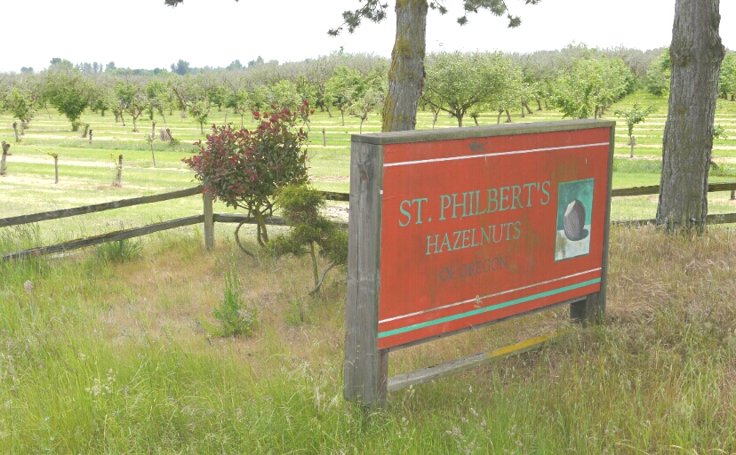
Saint Philbert
Religious nuts

I stopped at the Harrisburg Diner for lunch: an enchilada omelette that I still have to polish off. Cheap supper!

Once in Eugene, I had no idea where to stay. The county campground charges $30 for everyone, whether you're driving an RV or pitching a tent. For the difference, I'd rather stay in a motel. So I continued on. Once in Eugene, I found the major east-west bike path and headed west. Doesn't make much sense, does it? Well, hold on.

The Bike Friday factory is right beside the path. I was surprised to find it there, and stopped to pay them a visit. (De has a Bike Friday.) One of the workers was leaving - he looked like a swami. (Eugene's a funky town.) Their showroom salesman came out to inspect my Co-Motion, with its S&S couplings that allow the frame to be disassembled. He was impressed with the welding handwork.

And then it was on to the Co-Motion factory, to show the Old Coot (my co-pilot) where our steed was born. But, its being 6:00 pm on the Friday of a holiday weekend, there was nobody to be found. So I sat down and ate some more omelette and checked my email. Then, - what do you know? - one of the owners pulled up on his bike. He had returned to pick up a few items. We had a nice conversation that concluded with his offering the grassy yard next to the plant as a campsite. "But," he said, "watch out for the automatic sprinklers in the morning!" He didn't know what time they came on. I'll probably find out.

tent under the canopy
I actually camped on the grass.

The Old Coot goes boating

Thursday, May 23, 2013

Still in Corvallis

Day 5: Thursday, May 23, 2013
Corvallis: 0 miles


The NOAA weather report for Corvallis is calling for 90% chance of rain today, 100% tonight, with winds up to 25 mph this afternoon. The desk clerk says that Portland is also in for some nasty weather. So I've decided to stay put. But here it is 11:30 and nothing is happening yet. Are the fates against me? There's only a 70% chance of rain tomorrow. I'll move on then, and will probably get soaked. I think it's time to start planning some alternate endings for this trip.

I brought along my original DALMAC bicycle flag, from the first DALMAC I rode, back in 1975. I figured it would be appropriate, since I'll be staying in Michigan to ride DALMAC again this year. Before I left, Chris and I laminated the flag, which was showing signs of age, with the film that some R/C sailplane pilots use to cover their wings. But it is not holding up to the constant whipping back and forth in the slipstream. So I'll visit a fabric store and pick up a scrap of material to replace it, and batten down the old flag so that it survives the trip.

DALMAC flag
Beat-up DALMAC flag

The photo was taken several days later, after the new flag had gotten hung up on a barbed-wire fence. Oh, well - it still works.

Evening: I think I've been played for a fool. There has been rain today, but only for an hour. And the wind hasn't been that bad. I could have made it to Eugene today.

Oh, well. This gave me a chance to catch up on my blogging, and to learn why Android is a poor substitute for Windows, for someone who's used Windows for 30 years.

Wednesday, May 22, 2013

Corvallis, OR

Day 4: Wednesday, May 22, 2013
Dallas to Corvallis: 31 miles


I slept in this morning, until 7:30. By the time I showered, cleaned my gear, and made an excursion to the local Safeway, it was noon. And it was raining.

But that was no big deal, right? After all, I'm now in the Willamette River Valley. It's only about 60 miles to Eugene, and we made that in a day last time.

But that was in good weather, and probably with a tailwind. Rain doesn't do much for a biker's speed. And then there was the wind. With the coming of the rain, it had shifted around to the south, and at times was gusting to 20 mph. It made for a steady 6 mph pace on the flat. Eugene? No way!

bike path
The bike path south of Rickreall

The Willamette Valley looked much the same as it did in 1981, with many of the fields used for research crops. The valley is one of very few places in the world that is perfect for growing filberts. It looked much the same, but a whole lot wetter. The highlight of the day was encountering a model train hobby shop in the middle of nowhere, along the bike path that runs for ten miles or so south of Rickreall on Highway 99W. I stopped in to check it out, and the proprietor talked my ear off for a good hour.

A sea of white
A sea of white: crop research

Wherever you go, you'll find the town dump. Or county landfill. Or whatever. Approaching Corvallis, I saw a gigantic one. I just had to take a snapshot of the sign showing the name of the road. It kinda goes along with the one from the Whalen Island post, doesn't it?
appropriate name
Appropriate place name

What with the late start and all, I was glad to stop in Corvallis at 7pm. The Motel 6 here is much nicer than the local motel in Dallas, and has great wi-fi. I splurged on a meal at Pastini, across the street, then crashed once again, and awoke at 2:30 am to clean my gear and try to pump out some text.

Tuesday, May 21, 2013

Dallas, OR

Day 3: Tuesday, May 21, 2013
Whalen Island County Park to Dallas: 70 miles


Rainy day start
Ready for a rainy day ride

Grey Oregon seaside
A grey Oregon seaside

The word was right. Soon after we retired, it began to drizzle. In the morning, we prepared ourselves for a wet day. The drizzle turned to a steady rain that detracted from the joy of cycling Highway 101 with its hilly curves and on-again, off-again shoulders. Twenty miles later, just past the town of Neskowin, I was glad to turn off the coastal highway and follow the old Highway 101 up into the hills. In spite of the rain, it was a spirit-lifting experience: in ten miles, I encountered maybe half a dozen cars.

The scenic route
The scenic route was worth it.

Still, it was wet. An unpopulated, scenic road can do only so much for a person whose spirits have been dampened by a slog through mile after mile of rain. The climb over the coastal mountain range along Highway 18 was not joyful. The map said that there was a campsite in Grand Ronde, but I sure didn't feel like camping.

When you're cold, wet, and tired, don't underestimate the power of a lunch stop at a country store to boost your willpower to continue.

Grand Ronde was once the western station point on the Willamina and Grand Ronde Railroad, a logging line that ran up into the mountains. As the trucks took over, the railroad's business died out. Now, its tracks are gone. In 1981, trains still ran. Now, the engine house is a garage for logging trucks and the depot has been converted to other use. The big game in town is the Spirit Mountain Casino, a huge development for a town with a population of about 300. Although it provides jobs, I sensed a bit of resentment from some folks I talked with.

The alternative to a campsite in Grand Ronde was either a stay at the casino or a motel in Dallas, some 20 miles down the road. The casino just wasn't my style, so I made for Dallas. By the time I found a motel and got to my room, it was 9 pm. It had been a long, wet day. My bike and panniers were filthy with road grime. The wi-fi was terrible, and I was so exhausted that I didn't bother cleaning my gear or showering. I was out before I even turned off the lights.